Castner Scrapbook v.7, Walks, Views, Maps, page 8
Historical Images of Philadelphia Castner Scrapbook Collection
Item Info
Source: Print and Picture Collection
Notes:
Item pdcl00012, full page [image dimensions 25.0 cm x 33.5 cm]:
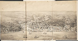
"The old city as viewed from Sparks' shot tower, located not far from Old Swedes' Church in Southwark, appeared to be busy and crowded with residences as well as buildings for trade and commerce. The tall ship houses and dry dock of the Navy Yard, and the waterfront warehouses and docks are visible in the east and east-southwest views (Nos. 11 and 12) above Old Swedes' Church (with the white spire) and Bethel Baptist Church in Front Street. The west view (No. 13) is along Carpenter Street, and the northwest view (No. 14) looks down upon the intersection of 2nd and Christian Streets and Moyamensing Avenue."--OPEP, p. [8-9].
For commercial image use please contact Bridgeman Art, http://www.bridgemanart.com/
Aerial southeast view of the city, facing the Delaware River. Residential and commercial buildings along streets. Left corner, in the foreground, Bethel Baptist Church. Steeple of Old Swedes' Church in the background, along with Navy Yard, waterfront warehouses and docks, tall ships on the river. Trees line some of the streets.
Bibliography:
Reprinted in: Old Philadelphia in early photographs, 1839-1914/edited by Robert F. Looney. New York: Dover Publications, c1976.
Geocode Latitude: Geocode Longitude:-75.146442
Geocode Latitude:39.934654
Call Number: A917.481 P536 v.7
Creator Name: Castner, Samuel, Jr., 1843-1929 - Compiler
 53
53  1B
1B  1B
1B  1C
1C 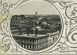 1C
1C  1C
1C  0
0  1B
1B 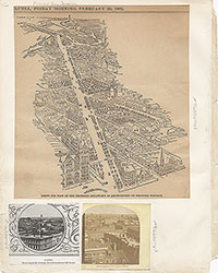 1C
1C  2
2  2
2  2
2  2
2  2
2  3
3  11
11  11
11 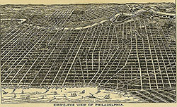 14
14  14
14  15
15  15
15 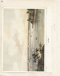 16
16  17
17  17
17  18
18  19
19  19
19  20
20  21
21 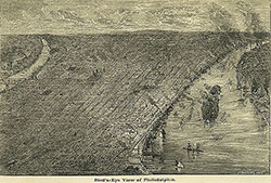 22
22 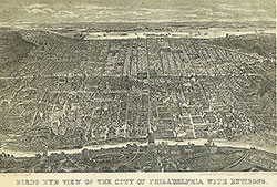 22
22  38
38  42
42  31
31  43
43  34
34  43
43  43
43  18
18  1
1  2
2 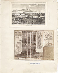 3
3 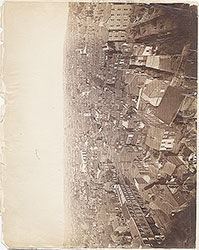 4
4 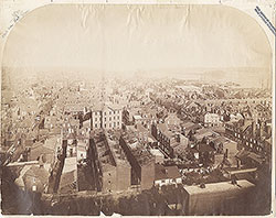 5
5  6
6 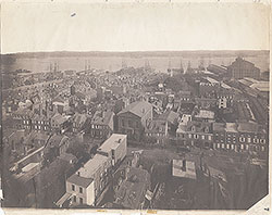 7
7 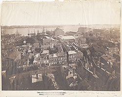 8
8
 9
9  10
10  11
11  13
13  14
14  15
15  18
18  19
19  20
20  21
21  22
22  23
23 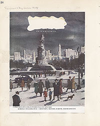 24
24  25
25  26
26  28
28  31
31  32
32 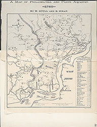 33
33  34
34  35
35  36
36  37
37  38
38  39
39 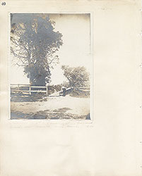 40
40  43
43  43
43  44
44  45
45  46
46 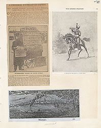 47
47 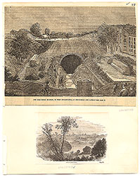 17
17 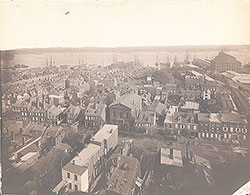 7
7  8
8 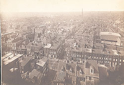 6
6 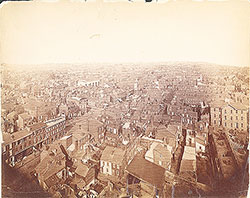 4
4 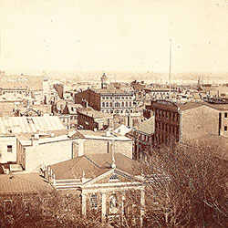 2
2  47
47  53
53  53
53  54
54 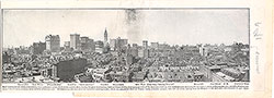 53
53  55
55  56
56  57
57  49
49  50
50  51
51  52
52  57
57  58
58 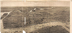 59
59 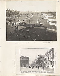 53
53  63
63  64
64  64
64 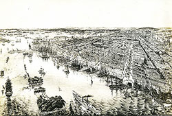 65
65  67
67 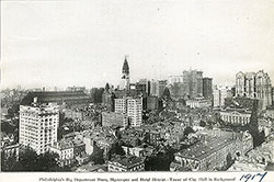 67
67  68
68  70
70  69
69  69
69 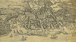 71
71  72
72  74
74  57
57  57
57  57
57  57
57  57
57  57
57  57
57  57
57  60
60  61
61  62
62  63
63  64
64 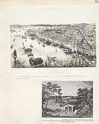 65
65  66
66 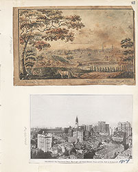 67
67  68
68  69
69 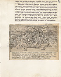 71
71  73
73  74
74  75
75  76
76  77
77  78
78  79
79  79
79 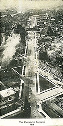 80
80  80
80  80
80  84
84  85
85  85
85  86
86  86
86  91
91  93
93 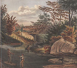 97
97  76
76  78
78  79
79  80
80  81
81  82
82  83
83  84
84  85
85  86
86  87
87  88
88  89
89  90
90  91
91  92
92  93
93  94
94  00
00  97
97  97
97  97
97  97
97  97
97  97
97  97
97  97
97  97
97  97
97  12
12  27
27  29
29  30
30  41
41  77
77  95
95  96
96 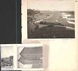 53
53  43
43  43
43  57
57