Castner Scrapbook v.7, Walks, Views, Maps, page 71
Historical Images of Philadelphia Castner Scrapbook Collection
Item Info
Item No: pdcc02320
Title: Castner Scrapbook v.7, Walks, Views, Maps, page 71
Media Type:
Scrapbooks
Source: Print and Picture Collection
Notes:
Item pdcc00622 [image dimensions 11.6 cm x 21.0 cm]:
Halftone reproduction of a bird's eye view, dated 1702, of the Philadelphia waterfront and environs. Shows two boats, lower left, entering Dock Creek. The Blue Anchor Inn stands to the right of the bridge, near the mouth of the creek. The opening of caves are shown at the foot of Chestnut Street. Here some of the early settlers lived until they built their homes. High Street (now Market) is shown with market houses in the center over which flies the British flag. Duck Pond, upper center, was located at what is now 4th and Market Streets. Nearby stands the Friend's Public School. The Windmill in the river represents the site of Windmill Island, removed in 1891-93.
Call Number: A917.481 P536 v.7
Creator Name: Castner, Samuel, Jr., 1843-1929 - Compiler
 53
53  1B
1B  1B
1B  1C
1C  1C
1C  1C
1C  0
0  1B
1B 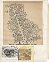 1C
1C  2
2  2
2  2
2  2
2  2
2  3
3  11
11 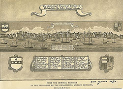 11
11  14
14  14
14  15
15  15
15 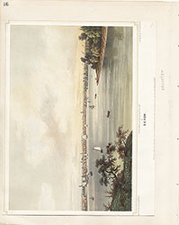 16
16  17
17  17
17  18
18 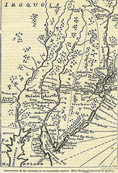 19
19  19
19  20
20  21
21 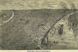 22
22 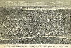 22
22  38
38  42
42  31
31  43
43  34
34  43
43  43
43  18
18  1
1  2
2 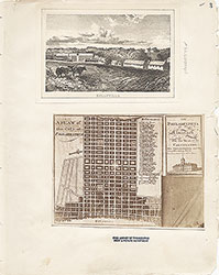 3
3  4
4  5
5  6
6  7
7 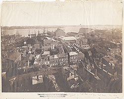 8
8  9
9  10
10  11
11  13
13  14
14  15
15  18
18  19
19  20
20  21
21  22
22  23
23 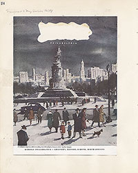 24
24  25
25  26
26  28
28  31
31  32
32 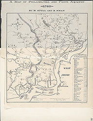 33
33  34
34  35
35  36
36  37
37  38
38  39
39  40
40  43
43  43
43  44
44  45
45  46
46 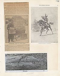 47
47  17
17  7
7  8
8  6
6 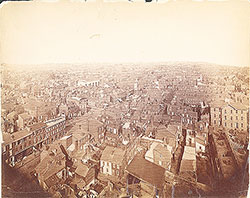 4
4  2
2  47
47  53
53  53
53 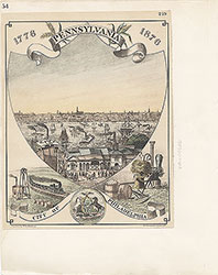 54
54  53
53  55
55  56
56  57
57  49
49  50
50  51
51  52
52  57
57  58
58 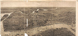 59
59  53
53 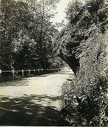 63
63 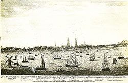 64
64 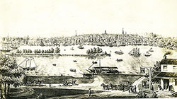 64
64 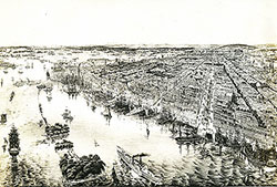 65
65  67
67  67
67  68
68  70
70  69
69  69
69 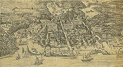 71
71  72
72  74
74  57
57  57
57  57
57  57
57  57
57  57
57  57
57  57
57  60
60  61
61  62
62  63
63  64
64 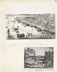 65
65 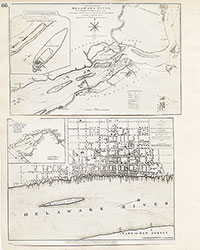 66
66  67
67  68
68  69
69 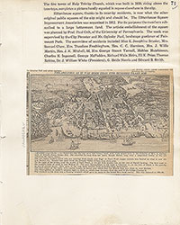 71
71
 73
73  74
74  75
75  76
76  77
77  78
78  79
79  79
79 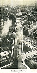 80
80  80
80 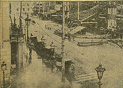 80
80 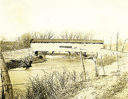 84
84 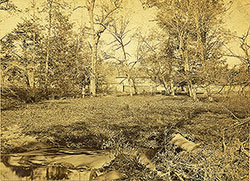 85
85  85
85  86
86  86
86  91
91  93
93 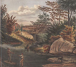 97
97  76
76  78
78  79
79  80
80  81
81  82
82  83
83  84
84  85
85  86
86  87
87  88
88  89
89  90
90  91
91  92
92  93
93  94
94  00
00  97
97  97
97  97
97  97
97  97
97  97
97  97
97  97
97  97
97  97
97  12
12  27
27  29
29  30
30  41
41  77
77  95
95  96
96 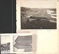 53
53  43
43  43
43  57
57