Castner Scrapbook v.18, Chestnut Street – Residences 1, page 7
Historical Images of Philadelphia Castner Scrapbook Collection
Item Info
Historic Street Address: 403 N Lansdowne Ave, Drexel Hill, PA
Historic Street Address: Willow Grove Avenue & Cherokee Street
Media Type: Scrapbooks
Source: Print and Picture Collection
Notes:
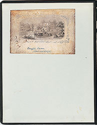
Item 1, top: Image of "Runnymede, the Country House of A. J. Drexel" (as captioned). The residence was on Lansdowne Avenue, in what became Drexel Hill, PA. The house, named Runnymede, was built in 1850, and purchased by Anthony J. Drexel in 1882, as a country residence. It burned down in 1908. In 1917, the Archdiocese of Philadelphia puchased the large property, and in 1955, Monsignor Bonner High School for Boys was established on the site, and today includes Archbishop Prendergast for Girls. Engraving by (J?) Petry Petry, for an unidentified publication (probably The Times-Philadelphia), 17 x 11.5 cm, undated.
Item 2, center: Image of "Druim-Moir, the Residence of H. H. Houston" (as captioned). Druim-Moir Castle was built by G. W. & W. D. Hewitt in the Romanesque style in 1886, for Philadelphia businessman/philanthropist Henry Howard Houston. "Druim-Moir" means "Great Ridge" in Scottish Gaelic. The 30-room mansion is located at Cherokee Street & Willow Grove Avenue, in an historic district in Chestnut Hill. It was added to the National Register of Historic Places in 1979. Engraving by (J?) Petry for an unidentified publication, 16 x 10 cm, undated.
Items 3 and 4, bottom: Images of the West Philadelphia residence of the Anthony J. Drexels, at the SE corner of 39th & Walnut Streets. It was a 45-room Italianate mansion, which was replaced after Drexel's death in 1893 by another mansion, for businessman/philanthropist Samuel Fels (today, the UPenn Fels Institute of Government). On the bottom left, engraving by Van Ingen-Snyder for an unidentified publication, 11 x 9.5 cm, undated. On the bottom right, a photograph, 11.5 x 9 cm, undated.
Creation Year: 1845
Geocode Latitude: Geocode Longitude:-75.200266
Geocode Latitude:39.953829
Call Number: A917.481 P536 v.18
Creator Name: Castner, Samuel, Jr., 1843-1929 - Compiler
G. W. & W. D. Hewitt - Architect
Van Ingen-Snyder - Engraver
 (inside front cover)
 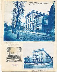 0a
0a  0b
0b 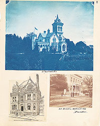 1
1 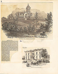 2
2  3
3  4
4  5
5  6
6 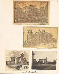 7
7
 8
8  9
9 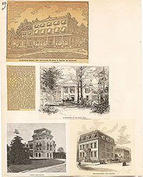 10
10  11
11  12
12  13
13 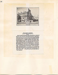 14
14  15
15  16
16  17
17 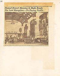 18
18 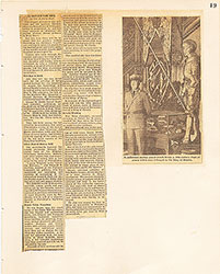 19
19 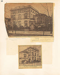 20
20 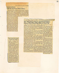 21
21  22
22 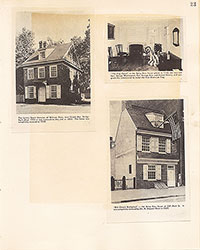 23
23 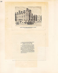 24
24  25
25  26
26  27
27  28
28  29
29 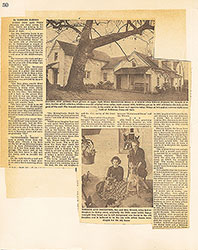 30
30  31
31  32
32  33
33 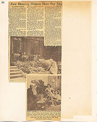 34
34 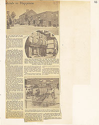 35
35 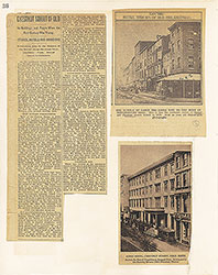 36
36  37
37  38
38  39
39  40
40 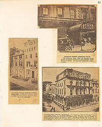 41
41 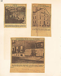 42
42  43
43  44
44  45
45  46-47
46-47 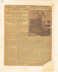 48
48 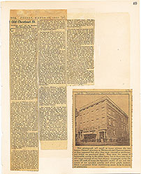 49
49 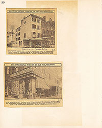 50
50 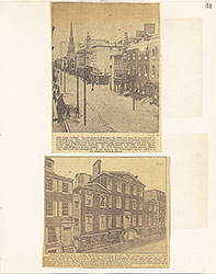 51
51  52
52 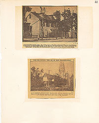 53
53 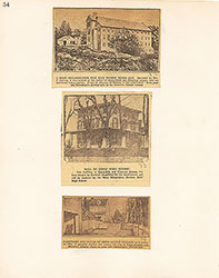 54
54