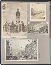
Castner Scrapbook v.6, Market Street, page 50
Historical Images of Philadelphia Castner Scrapbook Collection
Item Info
Historic Street Address: Eighth and Market Streets
Media Type: Scrapbooks
Source: Print and Picture Collection
Notes:
Item pdcc00532, top [image dimensions 12.8 cm x 17.8 cm]:
Caption: Market Street, which extends westaward from the Delaware across the city, theoretically considered the center thoroughfare. All that part of the city lying above it is termed North Philadelphia and that below South Philadelphia. The immense structure of the City Hall intersects Market Street about midway between the Delaware and Schuylkill Rivers.
Halftone reproduction of photograph showing Market Street with City Hall in the distance. Reading Terminal is shown on the right with the awnings of the Hotel Vendig visible just beyond. Well-dressed ladies and gentlemen suggest an affluence in this section of Market Street. Horse-drawn carriages share the road with electric trolley cars.
Notes:
Item pdcl00078, bottom [image dimensions 8.3 cm x 7.0 cm]:
"Market Street in this photograph resembles a town of the old West, with its covered wagons and sheltered walks. The awning poles at the curbs doubtless served as hitching posts, and the sentry box at the corner, with gas lamp on top, was probably used as a board for posting advertisements and other broadsides."--OPEP, p. 82.
The street, with buildings. Horse-drawn wagons on the street. Awnings stretched over sidewalks. Signs on buildings: "Nicholls, House & Sign Painting" ; "Horses & Gigs" ' "Comm...ation for [La]ncaster {Col]umbia, York, [...]hisburc...". Sentry box on corner, with gas lamp on top.
Building demolished: YES
Bibliography:
Reprinted in: Old Philadelphia in early photographs, 1839-1914/edited by Robert F. Looney. New York: Dover Publications, c1976.
Geocode Latitude: Geocode Longitude:-75.154613
Geocode Latitude:39.951257
Call Number: A917.481 P536 v.6
Creator Name: Castner, Samuel, Jr., 1843-1929 - Compiler
Cornelius, Robert, 1809-1893 - Photographer
- Animals
- Carriages & coaches
- Carts & wagons
- Horses
- People
- Gaslight fixtures
- Center City
- Hotels
- Street railroad tracks
- Advertisements
- Stores
- Awnings
- Market East
- Nicholls, House & Sign Painting
- Guardhouses
- Reading Terminal
- Hotel Vendig
- Trolley cars
- Horse-drawn vehicles
- Streetcars
- Pedestrians
- Cobblestone streets
- Costume (mode of fashion)
- Street scenes
- Eighth Street
- Market Street
 1A
1A 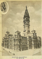 1A
1A 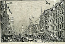 1A
1A 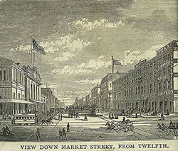 1A
1A 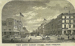 1A
1A  1B
1B  1B
1B 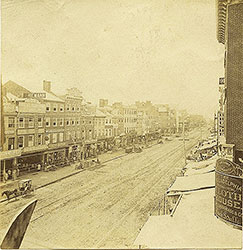 1B
1B 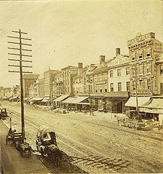 1B
1B  1C
1C  1C
1C  1D
1D 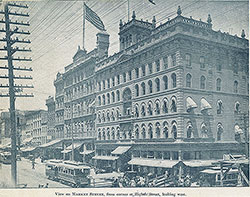 4
4  4
4 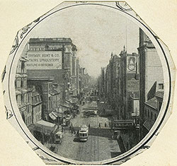 2
2  3
3 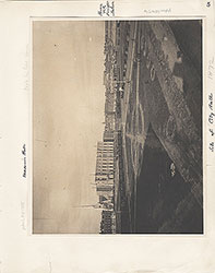 5
5  6
6  1
1  1B
1B 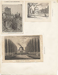 1C
1C  1D
1D  2
2  2
2 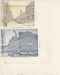 4
4  6
6  18
18  18
18 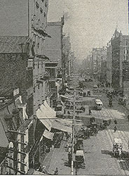 18
18  19
19  18
18 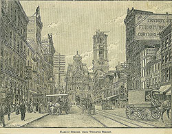 19
19  21
21  22
22  23
23 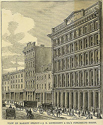 23
23  23
23  24
24  24
24  24
24  24
24  24
24  25
25  25
25 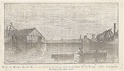 25
25  26
26  26
26  26
26  26
26  26
26  26
26  27
27  27
27  27
27  27
27  27
27  9
9  8
8  11
11  7
7 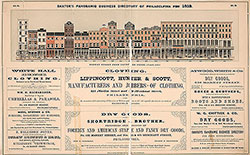 8
8  9
9  10
10 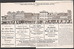 11
11 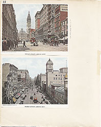 12
12  13
13  14
14  15
15  16
16  17
17 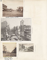 18
18  19
19 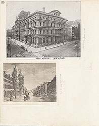 20
20  22
22  23
23  24
24  26
26  27
27  27
27  27
27 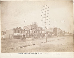 28
28  29
29 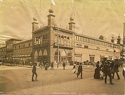 30
30  30
30  31
31  31
31  32
32  32
32  33
33  33
33  33
33  33
33  33
33  33
33  34
34  34
34 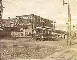 34
34  34
34  34
34  35
35  35
35  35
35  35
35  35
35 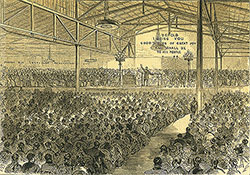 36
36  36
36  36
36  37
37 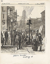 38
38  39
39  39
39 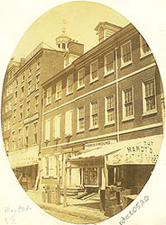 39
39 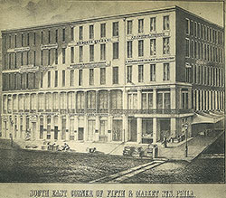 40
40 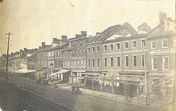 40
40  41
41  42
42  42
42 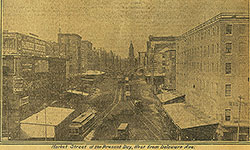 43
43  37
37 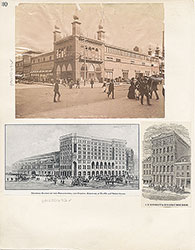 30
30  31
31  31
31  32
32  33
33 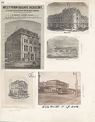 34
34 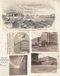 35
35  36
36  37
37 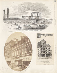 39
39  40
40  42
42  43
43 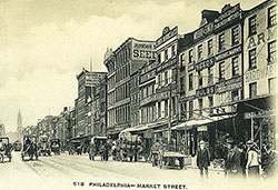 45
45 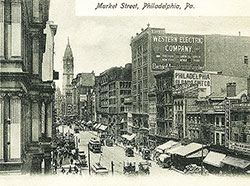 45
45  47
47 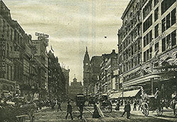 47
47 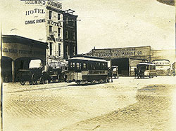 48
48  49
49 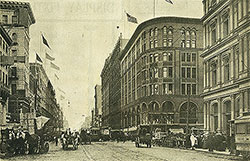 51
51  50
50 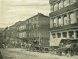 46
46  57
57  51
51 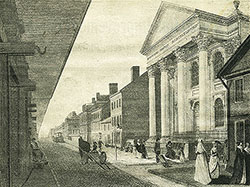 46
46 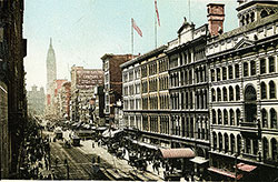 49
49  52
52 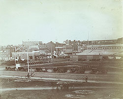 53
53  56
56  58
58 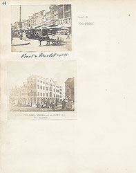 44
44  45
45  46
46 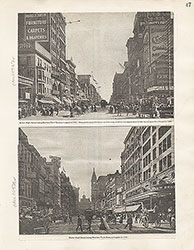 47
47  48
48  49
49 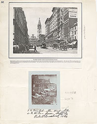 50
50
 51
51 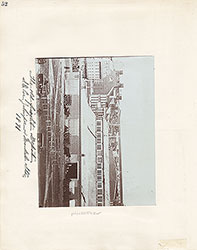 52
52  53
53 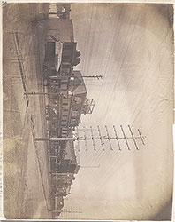 54
54  55
55  56
56  58
58 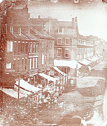 50
50 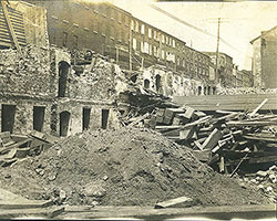 59
59 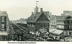 59
59  59
59  63
63 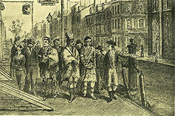 63
63  65
65  65
65 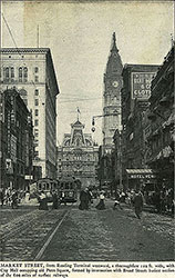 67
67 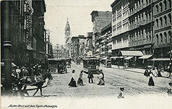 67
67 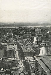 82
82 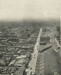 83
83 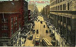 84
84 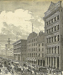 86
86  86
86 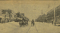 85
85 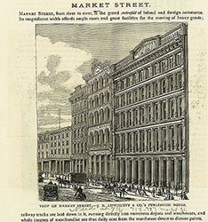 85
85  88
88  87
87 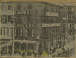 88
88  62
62  59
59  60
60 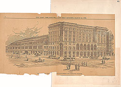 61
61  62
62  65
65  66
66 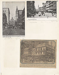 67
67  68
68  69
69  70
70 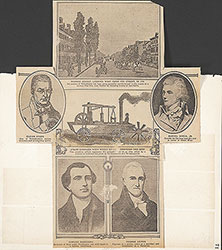 71
71  72
72  73
73  74
74  75
75  75
75  77
77  77
77 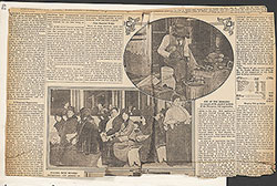 79
79  79
79  81
81  81
81 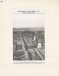 82
82  83
83 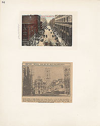 84
84  85
85 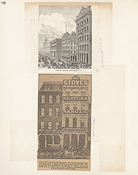 86
86  87
87  88
88  63
63 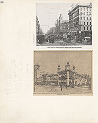 64
64  76
76  80
80  78
78 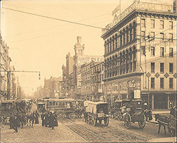 64
64  89
89  89
89  89
89  90
90  21
21  21
21  22
22 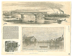 25
25 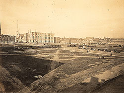 5
5