Castner Scrapbook v.4, Old Houses 1, page 38
Historical Images of Philadelphia Castner Scrapbook Collection
Item Info
Historic Street Address: Water and Dock Streets
Media Type: Scrapbooks
Source: Print and Picture Collection
Notes:
Item pdcc00273, bottom left [image dimensions 11.0 cm x 12.5 cm]:
http://www.ushistory.org/districts/fairmountpark/lemon.htm
Engraving depicts a large house surrounded by trees on a breezy Fall day. In the foreground a gentleman with a cane looks towards the house where two people on the covered porch meet his gaze. Outbuildings are shown in the distance. Above them a flock of birds fly fast in the wind.
The Hills house sat on the site of the present-day Lemon Hill Mansion. From 1770 to 1799 it was the country seat of Robert Morris, a signer of the Declaration of Independence and financier of the Revolution. Following a series of financial disasters Morris was sent to debtor's prison, and in 1799 the estate was confiscated and the building razed.
Building demolished: YES ca. 1799
Notes:
Item pdcl00018, top [image dimensions 15.9 cm x 21.3 cm]:
"In 1860, Water Street was actually the river front and the location of wharfs and riverfront activity. This scene is close to the historic point of William Penn's landing and the Blue Anchor Inn, which marked the spot just north of Dock Street."--OPEP, p. 19.
The intersection, with large commercial building, with signs: "No. 2 Chains & Anchors, Daniel McCarthy, broker in iron and metals" ; "Commercial house" ; "Eugene Duffy" ; "Telegraph house". A man stands on sidewalk, trolley tracks on street. Horse-drawn carts on street.
Building demolished: YES
Bibliography:
Item pdcl00018: Reprinted in: Old Philadelphia in early photographs, 1839-1914/edited by Robert F. Looney. New York: Dover Publications, c1976.
Geocode Latitude: Geocode Longitude:-75.142046
Geocode Latitude:39.945136
Call Number: A917.481 P536 v.4
Creator Name: Castner, Samuel, Jr., 1843-1929 - Compiler
Morris, Robert, 1734-1806
 1A
1A  1B
1B  1B
1B 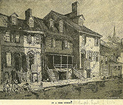 1B
1B  1C
1C  1D
1D  1E
1E  1E
1E  1
1  2
2  2
2  2
2  3
3  4
4  3
3  4
4 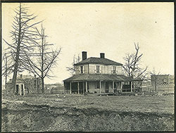 5
5 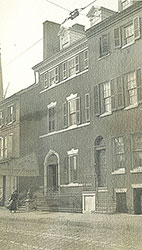 5
5  5
5  6
6  7
7  9
9  10
10  11
11  14
14  14
14 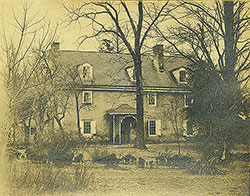 13
13 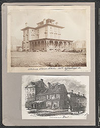 1A (inside front cover)
 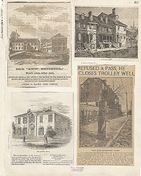 1B
1B  1C
1C  1D
1D 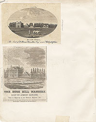 1E
1E 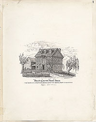 1
1  2
2  3
3  4
4  5
5  6
6  7
7  8
8  9
9  10
10 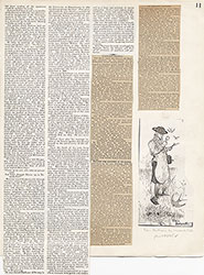 11
11  12
12 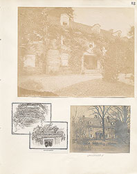 13
13  14
14  15
15  16
16  18
18  18
18  18
18  19
19  19
19  19
19 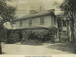 20
20 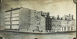 21
21  21
21  21
21  22
22  23
23  25
25  25
25  25
25  26
26  27
27  28
28  17
17  18
18 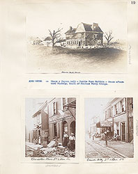 19
19  20
20  21
21  22
22 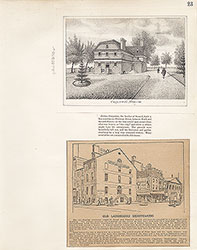 23
23  24
24  25
25  26
26  27
27  28
28  29
29  30
30 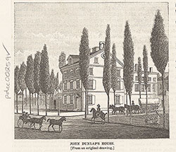 30
30 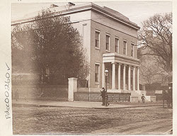 30
30  31
31  32
32 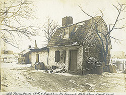 32
32 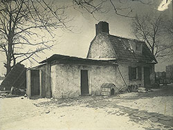 33
33 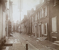 33
33  34
34 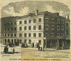 34
34 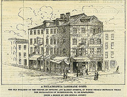 35
35  36
36  36
36  37
37 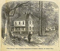 38
38  40
40  41
41  30
30  31
31  32
32  33
33 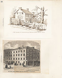 34
34  35
35  36
36  37
37 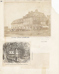 38
38
 39
39  40
40  41
41  42
42  43
43 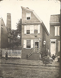 39
39  38
38  45
45  45
45  45
45 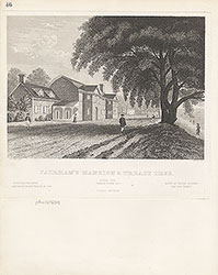 46
46 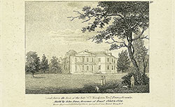 47
47 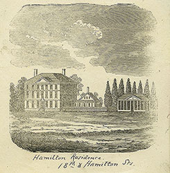 47
47  48
48  50
50  51
51  55
55  44
44 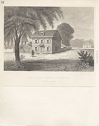 52
52 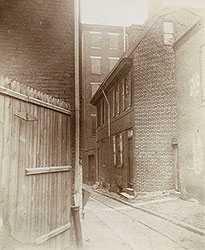 58
58  56
56  44
44 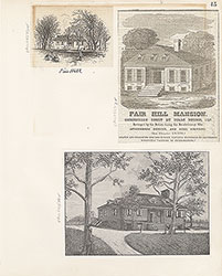 45
45 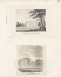 47
47 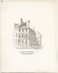 48
48  49
49  50
50 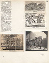 51
51  53
53  54
54  55
55  56
56  57
57  58
58  58
58  59
59  60
60 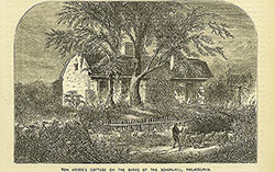 61
61  61
61  62
62  62
62  62
62  63
63  65
65  66
66  64
64  67
67  68
68 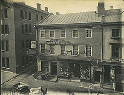 69
69  69
69 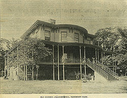 70
70 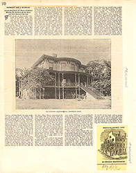 70
70 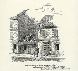 72
72  74
74  75
75  76
76  78
78  77
77  79
79 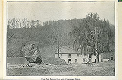 81
81  81
81  82
82  83
83 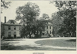 84
84 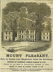 85
85 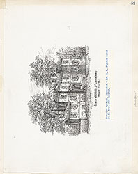 59
59 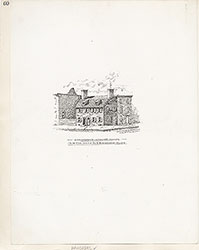 60
60  61
61 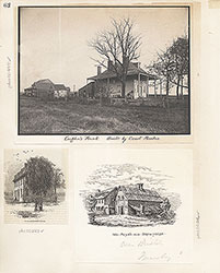 62
62  63
63 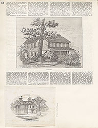 64
64  65
65  65
65  66
66  67
67  68
68 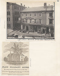 69
69  70
70  71
71  72
72  73
73  74
74  75
75  76
76  77
77 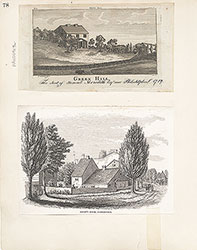 78
78  79
79  80
80  81
81  82
82 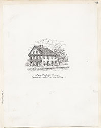 83
83  84
84  85
85  85
85  86
86  87
87 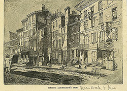 87
87  88
88  90
90  91
91  92
92  92
92  94
94  95
95  96
96  89
89  89
89 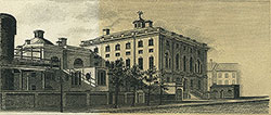 Inside back cover.
  86
86  87
87  88
88  89
89  90
90  91
91  92
92  93
93  93
93  93
93  93
93  93
93 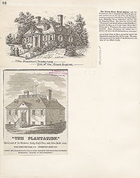 94
94  95
95  96
96 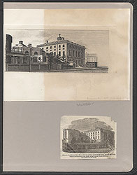 (inside back cover)